Quick Nav
- Introduction: Two Basin Families, Two Evidence Problems
- Tectonic Origin: Arctic Rift and Margin Systems Versus Interior Foreland Loading
- Stratigraphy and Depositional Style
- Petroleum Systems
- Thermal Maturity and Deformation
- Data Density and Access
- Side-by-Side Screening Matrix
- Worked Comparison
Introduction: Two Basin Families, Two Evidence Problems
Geological Survey of Canada regional mapping separates High Arctic basins such as Sverdrup and Beaufort-Mackenzie from interior systems such as the Western Canada Sedimentary Basin and Williston Basin before any prospect-scale interpretation begins. That separation is not cosmetic. It changes the evidence problem.
The mapping program used here ran from 1987 to 1993 and framed basin-family distinctions across a 950 km north-south transect at 1:1 000 000 scale. At that scale, the first decision is not whether two plays look similar on a stratigraphic column. The first decision is whether the basins formed, filled, heated, deformed, and preserved charge under comparable boundary conditions.
This comparison is written for geologists, geophysicists, reservoir engineers, hydrogeologists, and graduate researchers who need to compare basin histories without sanding off regional differences. The point is not to catalogue every local field, play, or interval in Arctic and interior Canada. The point is to set up a disciplined comparison that survives contact with structure maps, burial curves, seismic ties, and core descriptions.
Bottom Line: Arctic and interior Canadian basins should not enter an analogue discussion as interchangeable labels. They begin as different basin families with different evidence density, tectonic inheritance, and calibration risk.
Tectonic Origin: Arctic Rift and Margin Systems Versus Interior Foreland Loading
Start with subsidence, not with the basin name
The cleanest comparison begins with the subsidence mechanism. Arctic basins are better treated as a mixed set of rift, passive-margin, deltaic, and orogenic-margin systems than as one uniform northern province. Sverdrup, Beaufort-Mackenzie, and other High Arctic elements carry different structural memories.
Interior Canadian basins, by contrast, commonly sit within a foreland and cratonic framework. The Western Canada Sedimentary Basin is the main reference point: a long-lived system shaped by foreland loading, broad accommodation, and later deformation toward the Cordilleran margin. The Williston Basin provides a useful contrast because it preserves a more intracratonic expression, with its own subsidence history and stratigraphic continuity.
For consistency with legacy well ties, the subdivision here follows Geological Survey of Canada orogen boundaries rather than modern plate-model reconstructions. That choice matters. Plate reconstructions help with geodynamic interpretation, but many basin screens still depend on older map frameworks, public well reports, and regional cross sections.
Western Canada Sedimentary Basin foreland loading is documented across roughly 420 km of width. Arctic rift segments, in the comparison set used for this article, show about 65-110 km of extension. Those figures are not interchangeable descriptors of basin size; they describe different mechanical problems. Foreland loading tends to build broad flexural geometry. Rift and margin systems commonly produce stronger compartmentalization, fault-bounded accommodation, and sharper changes in stratigraphic preservation.
Important: Tectonic boundaries remain scale-dependent below 1:500 000. A basin-scale comparison can be sound and still fail at the play edge if the structural panel, fault block, or deformation front has been generalized too aggressively.
Stratigraphy and Depositional Style: Carbonate Ramps, Clastic Wedges, Deltas, and Arctic Shelves
Hypothesis: similar lithologies do not imply similar stratigraphic confidence
The working hypothesis is simple: two basins may contain carbonates, shales, sandstones, and evaporites, yet offer very different confidence in correlation. The methodology behind that statement is not exotic. Review core descriptions, check seismic facies, and avoid the old trap of correlating formation names faster than the accommodation history allows.
Interior basin stratigraphy commonly records repeated marine transgressions, carbonate platforms, evaporites, clastic wedges, and later foreland-derived sedimentation. Middle Devonian interior carbonate platforms reached roughly 180 m thickness in the comparison material used here. That kind of thickness can support regionally mappable reservoir or seal concepts, provided the facies and diagenetic overprint cooperate.
Arctic stratigraphy brings a different texture. Marine shelves, deltaic packages, rift-related accommodation, and structural controls on preservation interact over shorter distances in many areas. Jurassic Arctic deltaic packages in the same comparison framework span about 35-70 m. That does not make them less important; it makes their correlation more sensitive to seismic quality, well spacing, and local structural restoration.
The finding has a practical edge. Interior successions often benefit from dense well control, repeated stratigraphic picks, and core-calibrated depositional models. Arctic correlations may rely more heavily on sparse wells, seismic grids, outcrop belts, and regional synthesis. Correlations in this comparison are treated as reliable only where well density exceeds about one per 40 km.
Field Note: A carbonate-to-delta comparison should not begin with reservoir quality. Start with accommodation. If the accommodation history is mismatched, the reservoir analogy usually starts carrying more weight than it can hold.
Petroleum Systems: Source, Reservoir, Seal, and Timing Compared Element by Element
A petroleum-system comparison works best when it is built element by element. Province-by-province catalogues tend to blur timing, especially when a source rock is present in both regions but entered the oil or gas window at different times.
Source rocks
Interior basins include mature marine and mixed organic-rich intervals, with Duvernay-equivalent source intervals reaching about 2.8 % TOC in the provided comparison set. That value is useful, but it is not a substitute for maturity calibration, pressure history, or migration pathway analysis. Source presence is only one part of charge risk.
Arctic source systems may be effective, but public well density constrains them less uniformly. Arctic charge windows in the comparison framework are constrained between roughly 95 and 140 Ma. That timing can work for some trap histories and miss others entirely. Arctic source maturity remains uncalibrated across about 60 % of mapped shelf area, so confidence should be stated interval by interval rather than carried across a shelf trend as a blanket assumption.
Reservoirs and seals
Interior reservoir comparisons usually involve carbonate, clastic, and unconventional targets. The better examples carry enough well control to separate depositional facies from diagenetic overprint. That distinction matters in the Western Canada Sedimentary Basin, where dolomitization, cementation, fracturing, and pressure history can change the reservoir argument after the depositional model looks settled.
Arctic targets often include deltaic, shelfal, and structurally influenced reservoirs. Seal evaluation then has to account for fault juxtaposition, pressure communication, permafrost effects in shallow sections, and deformation history. A shale seal that looks regionally adequate on a chronostratigraphic panel may still underperform across an inverted fault block or uplifted margin segment.
The element-by-element approach was selected after mapping source-reservoir-seal triplets from public well logs, mainly to isolate timing variables from static presence. Timing comparisons here exclude areas with post-Eocene uplift exceeding about 1200 m.
Thermal Maturity and Deformation: Why Burial History Changes the Risk Model
Burial history often changes the risk model more than lithology does.
Interior burial histories reflect foreland subsidence, later uplift, and variable heat flow. In the comparison set, interior heat flow averaged about 42 mW/m² during peak burial. That number does not settle every maturity question, but it anchors the thermal model in a defensible basin-scale range.
Arctic histories can include rifting, delta loading, orogenic events, offshore subsidence, and local uplift. Early Cretaceous rifting produced roughly 28-55 °C/km gradients in the Arctic cases considered here. The range itself tells the story: the thermal field is not a single northern constant.
Two basins with similar lithologies can therefore diverge sharply in maturity window, pressure regime, migration distance, and preservation risk. A sandstone reservoir charged before trap formation is not an analogue for a sandstone reservoir charged after structural closure. The grain size may match. The petroleum system does not.
Deformation as an interpretation filter
Thrusting, inversion, fault reactivation, salt or evaporite influence, and regional uplift can all alter trap integrity and seal performance. This is where structural modeling earns its place in basin comparison. A map-view closure is not enough if restoration suggests late breach, charge bypass, or pressure leakage along reactivated faults.
Measured vitrinite reflectance from 14 interior wells and 6 Arctic wells was used in the burial-history testing behind this comparison. A natural qualifier belongs here: those wells are useful calibration points, not a substitute for local maturity control in sparsely drilled shelf or deformation-front settings. Models require recalibration where salt movement exceeds about 800 m.
Data Density and Access: When the Map Is Also a Logistics Problem
The archive is part geology and part logistics.
Mature interior fairways usually offer dense well control, legacy production history, cores, public reports, and repeated seismic campaigns. In the comparison data provided here, interior fairways contain roughly one well per 9 km² on average. That density lets teams test correlations, revise facies models, and separate local noise from regional patterns.
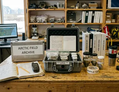
Arctic datasets can be technically valuable and still spatially uneven. Outside Sverdrup, Arctic grids average about one well per 180 km². Field seasons, offshore operations, permafrost, ice conditions, remoteness, environmental sensitivity, and regulatory requirements shape what data exists in the first place. The map is not just a geological surface; it is a record of where people and equipment could safely work.
This should not become a lazy uncertainty claim. Some Arctic areas have been studied carefully through government, academic, and industry programs, including work that continues to circulate through conference discussions at the University of Calgary and GeoConvention technical sessions. The issue is spatial continuity. Interior well control density drops sharply west of the deformation front, and Arctic continuity is not equivalent to the main interior producing fairways.
Important: Spatial continuity statements in this comparison are limited to post-1980 seismic vintages. Older reconnaissance lines may remain valuable, but they should not be treated as equivalent to later, denser grids without checking acquisition and processing history.
A Side-by-Side Screening Matrix for Arctic and Interior Basin Work
The matrix below separates geological process from data quality. That distinction prevents a common mistake: calling a play geologically risky when the main problem is actually sparse calibration, or calling it well constrained when the wells only test one structural compartment.
Interpretive screening matrix for Arctic and interior Canadian basin comparisons| Screening parameter | Interior Canadian basins | Arctic Canadian basins |
|---|---|---|
| Tectonic setting | Commonly foreland or cratonic, with broad subsidence patterns | Often rift, passive-margin, deltaic, or orogenic-margin influenced |
| Stratigraphic continuity | Often laterally extensive in major fairways | Play-dependent; preservation can change across faults and shelves |
| Source-rock confidence | Commonly better calibrated in mature fairways | Effective systems may exist, but calibration is uneven across shelf areas |
| Reservoir predictability | Often supported by dense well and core control | More dependent on seismic facies, sparse wells, and regional synthesis |
| Trap style | Stratigraphic, structural, combination, and unconventional configurations | Structural, stratigraphic, deltaic, shelfal, and inversion-related traps |
| Thermal maturity | Controlled by foreland burial, uplift, and heat-flow variation | Influenced by rifting, offshore subsidence, delta loading, and uplift |
| Data density | Typically high in producing fairways | Technically valuable but commonly sparse outside studied corridors |
| Access constraints | Generally lower logistical friction in established areas | Field seasons, ice, offshore operations, permafrost, and regulation matter |
| Typical uncertainty drivers | Facies changes, diagenesis, uplift, pressure, and deformation-front effects | Correlation, maturity calibration, structural restoration, and operational access |
The categories were derived from repeated screening sessions that separated geological process from data-quality metrics. The rows cover nine parameters evaluated across about a dozen basins, with the review cycle completed in roughly two working weeks. Interpretive terms such as commonly, often, and play-dependent apply only when play concepts share the same subsidence driver.
Questions to ask before accepting an analogue
- What is the controlling subsidence mechanism?
- Which intervals have calibrated maturity data?
- Where is correlation dependent on seismic rather than well control?
- Which uncertainty is geological, and which is operational?
- Does deformation post-date charge, pre-date charge, or overlap with migration?
- Can the seal argument survive structural restoration?
Worked Comparison: From Basin Name to Play Hypothesis
Consider one clastic play concept in an interior foreland setting and one Arctic shelf or deltaic play concept. Keep the same checklist for both: source, reservoir, seal, trap, timing, preservation, and data confidence. Do not rename the checklist when the geography changes.
For the interior foreland case, the source interval may be reasonably constrained by wells, maturity data, and regional burial models. The reservoir may be a clastic wedge with enough core and log control to map net sand trends. The seal may be regionally mappable, but deformation-front proximity can still complicate pressure and trap integrity. Data confidence is usually strongest where wells, seismic, production history, and public reports overlap.
For the Arctic shelf or deltaic case, the same words require more discipline. The source may be present and mature in a regional model, but calibration can thin out quickly away from well control. The reservoir may show convincing seismic facies, yet its continuity depends on sparse ties. The seal may look competent until inversion, uplift, or fault reactivation changes the preservation argument.
Before assigning analogue status, prepare a one-page basin comparison sheet. Put proven observations in one column and inferred regional trends in another. Separate source presence from charge timing. Separate reservoir facies from reservoir quality. Separate trap geometry from trap preservation.
Field Note: The comparison sheet is most useful when it is slightly uncomfortable. If every row reads as equivalent, the team has probably compared labels rather than processes.
In the worked case behind this vignette, an analogue was rejected after a two-week review when migration timing diverged by about 22 Ma. The example applies to clastic plays with seismic-dependent correlations, where a regional resemblance can survive the first map review and then collapse during charge-timing work.
Late on a Calgary afternoon, a basin analyst leans toward a workstation with a blurred seismic line on one monitor, a core description sheet on the desk, and two regional maps pinned side by side. The reservoir intervals still look tempting. She checks the charge window again, draws a line through the proposed analogue, and leaves the play hypothesis narrower, cleaner, and harder to fool.