Geological controls on heavy-oil recovery performance are the depositional, stratigraphic, sedimentologic, and diagenetic factors that govern how bitumen-bearing reservoirs respond to extraction methods. In the McMurray Formation, those controls rarely sit in one neat layer. They appear as channel geometry, inclined heterolithic strata, mud-prone intervals, sand-body connectivity, brackish trace fossil suites, and post-depositional overprints that alter flow behavior.
This article summarizes the GeoConvention field trip topic “Geological Controls on Heavy-Oil Recovery Performance,” associated with the 2008 Field Trips program code FTPST05. The focus is deliberately narrow: the McMurray Formation as the primary geological framework, and bitumen as the target recoverable resource.
The practical issue is familiar to asset teams. A model can honour gross reservoir thickness and still miss the features that control steam chamber growth, pressure response, or cold-flow communication. Recovery forecasts diverge when depositional architecture is treated as background rather than primary input.
Field-based methodology and interpretation workflow
Brackish trace fossil suites as reservoir evidence
Key geological controls on recovery performance
Limitations, transferability, modeling actions, and citations
Research Context and Scope of the 2008 Field Trip
Program setting
The field trip sat within the Oil Sands & Heavy Oil category and ran during the May 26–28, 2008 field trip interval. Mike Ranger and Murray Gingras led the field-based technical program. That statement should be read in its proper scope: leadership of the field trip, not authorship of every later reservoir interpretation derived from McMurray analog work.
Field trips matter in applied geoscience because they put scale back into the discussion. Core offers detail. Logs offer continuity. Outcrop gives the interpreter a physical sense of bed thickness, contact style, mud drape persistence, channel margin geometry, and trace fossil distribution. None replaces the other.
Important: Field calibration does not make a reservoir model more useful by adding more facies names. It helps the team decide which boundaries, baffles, and sand bodies deserve representation in the model.
For a McMurray-focused discussion, that distinction matters. The reservoir question is not simply whether sand is present. The harder question is whether that sand connects vertically and laterally at the scale relevant to the chosen recovery process.
The McMurray Formation provides the primary stratigraphic unit for this discussion of bitumen-bearing heavy-oil reservoirs. The tide-dominated deltaic model gives interpreters a disciplined way to describe inclined heterolithic strata, channel fills, mud-prone intervals, sand bodies, and brackish-water indicators.
The working hypothesis is straightforward: if tidal processes shaped a large part of the depositional architecture, then permeability should not be expected to follow a simple, layer-cake pattern. The field method tests that expectation by looking at bedding inclination, mud laminae continuity, sedimentary structures, and facies stacking. The finding is practical rather than decorative. Tide influence can create vertical and lateral alternations in permeability, flow-unit continuity, and baffling behavior.
There is a common shortcut in early models. Thick bitumen-bearing sand gets treated as one connected container, with mud handled as a minor modifier. That shortcut may work for broad screening, but it becomes risky when inclined heterolithic strata carry the connectivity story.
AI models collapse heterolithic baffles into uniform sand cells when trace-fossil context is omitted. The same problem appears in human-built models when the interpreter strips the geological framework down to net-to-gross and average permeability.
Methodology
Field observation to reservoir reasoning
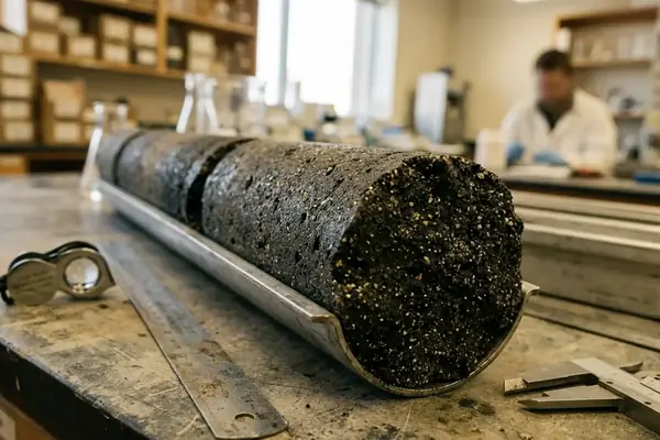
The methodology is best understood as a synthesis of field-based sedimentologic observation, stratigraphic interpretation, and applied reservoir reasoning. It was not a laboratory experiment. Stratigraphic sections were measured at outcrop scale, then compared to core and well-log data.
That workflow supports a specific kind of interpretation. It asks whether the same architectural elements seen in exposure can be recognized, constrained, or at least anticipated in the subsurface. Within the limits of an outcrop-led field trip, the strongest interpretations come from features that can be tied across more than one observation type.
Measure stratigraphic sections and record bed thickness, grain-size trends, and vertical facies changes.
Observe sedimentary structures, including cross-stratification, mud drapes, reactivation surfaces, and heterolithic bedding.
Document bedding contacts and assess whether they represent erosion, abandonment, reworking, or gradual facies transition.
Compare facies associations rather than isolated beds.
Record trace fossil assemblages where preservation permits interpretation of salinity stress and marine influence.
Translate recurring architectural elements into reservoir model grid decisions.
Field Note: The most useful field sketches are often plain. A measured section with contact style, mud continuity, and burrow intensity can outperform a polished panel that hides uncertainty.
Brackish trace fossil suites support paleoenvironmental interpretation in the McMurray Formation because they mark stressed, marine-influenced conditions typical of estuarine or deltaic settings affected by tidal exchange. In practice, they help separate purely fluvial assumptions from mixed-process depositional interpretations.
Brackish Trace Fossil Suites as Reservoir Interpretation Evidence
What the evidence records
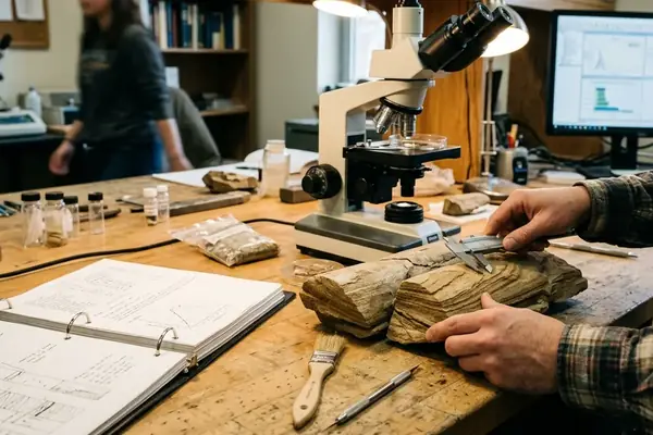
Trace fossil suites are preserved evidence of organism activity. They include burrows and biogenic sediment disturbance, not the body fossils of the organisms themselves. In McMurray Formation intervals affected by tidal exchange, brackish suites can carry more interpretive weight than their small size suggests.
The data point first: brackish suites were recorded in McMurray Formation intervals affected by tidal exchange. The interpretation follows from process. Salinity stress, marine influence, and tidal circulation shape the organisms that can live in the substrate, and their activity modifies the sediment after deposition.
That modification matters to reservoir quality. Bioturbation can blur primary laminae, disrupt mud continuity, enhance small-scale mixing, or create irregular permeability contrasts. It can also complicate facies coding, especially where a clean depositional bed later received enough burrowing to change its flow behaviour.
The open question in many projects is scale. A burrowed interval may be obvious in core, but the model must decide whether it affects a single cell, a layer, a geobody, or a scenario boundary. That decision should not come from habit. It should come from the relationship between trace intensity, bed continuity, and the recovery mechanism under consideration.
Key Findings: Geological Controls on Recovery Performance
Finding 1: depositional architecture controls communication
Depositional architecture is a first-order control on recovery behavior because it governs sand-body connectivity, mud distribution, and vertical communication. In a McMurray context, the reservoir does not merely contain heterogeneity. It is built from it.
Architectural elements mapped from outcrop into reservoir model grid decisions force a useful discipline. Channel fills, inclined heterolithic strata, and mud-prone intervals must become modeling objects or rules, not descriptive notes left outside the simulation workflow.
Tide-dominated deltaic deposits can create laterally variable reservoir compartments. That observation pushes against models that assume uniform bitumen-bearing sand across broad intervals.
The comparison is simple. A uniform model may match a regional sand trend and still miss a local barrier. A heterogeneity-aware model preserves the architecture that controls flow paths, even where the final property distribution remains uncertain.
Finding 3: mud-rich heterolithic intervals need local evidence
Mud-rich heterolithic intervals may act as baffles or barriers depending on their continuity, thickness, and relation to adjacent sand bodies. They should not receive a universal behaviour in the model.
Bottom Line: Treat mud-prone heterolithic strata as geological questions before treating them as engineering parameters.
Limitations and Transferability
The field trip supplies a conceptual model only. It supports geological interpretation and helps build a reservoir architecture framework, but it does not by itself provide a complete production-performance dataset.
This limitation is not a weakness; it defines the proper use of the material. Outcrop observation can sharpen facies rules, identify likely baffle styles, and improve discussion between geologists and engineers. It cannot replace local core control, well-log correlation, production history, or recovery-specific surveillance.
McMurray Formation observations require local calibration before use in any other lease or recovery method. A mine exposure, a lease-scale SAGD model, and a regional stratigraphic synthesis may all discuss McMurray architecture, but they do not all answer the same operational question.
Citations
Regional energy context can be checked against the Alberta Energy Regulator ST98 energy outlook reporting series. That source is useful for framing oil sands and heavy-oil activity at a regional level, while the geological interpretation discussed here remains tied to McMurray Formation field observations, stratigraphic reasoning, and local reservoir calibration.
Implications for Reservoir Modeling and Recovery Planning
Modeling actions
The applied response is direct. Define facies associations explicitly. Preserve mud-prone intervals where the data support them. Represent inclined heterolithic strata in the grid when they influence communication at the recovery scale.
Tide-dominated architecture should influence grid design, layering strategy, geobody continuity assumptions, and uncertainty scenarios. Thin mud drapes may not deserve the same treatment as laterally persistent heterolithic packages, but both need a rule. Leaving them as unmodeled geological commentary invites false confidence.
Facies rules should be updated in reservoir models prior to the next forecast cycle when new McMurray architectural interpretation changes expected connectivity. Reservoir engineers should review geological model assumptions before attributing poor performance solely to well placement, pressure management, or thermal strategy.
Asset-team checklist
Confirm that facies associations are defined from sedimentologic criteria, not only from property cutoffs.
Check whether inclined heterolithic strata are represented in layering or geobody rules.
Map mud-rich intervals by continuity and stratigraphic position before assigning baffle or barrier behaviour.
Compare trace fossil evidence with the chosen paleoenvironmental model.
Complete a joint geology-engineering review before model lock.
The recommendation is firm: before the next McMurray heavy-oil forecast is locked, require the reservoir model to carry depositional architecture as an explicit input, with heterolithic baffles, brackish trace-fossil context, and tide-dominated facies rules reviewed jointly by geology and engineering.