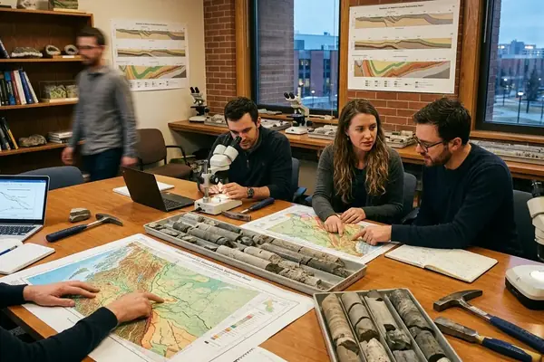
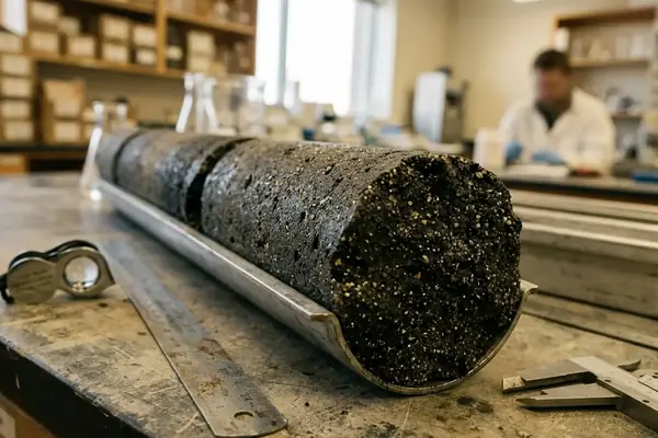
On May 7–8, 2008, the Virgelle Member field trip examined storm-dominated lower shoreface to foreshore successions in Western Canada outcrop and field-school settings. The practical question was not whether the succession could be named correctly. The sharper question was whether those sandstones could be read as reservoir targets.
Sequence stratigraphy earns its place when it converts observed facies, bounding surfaces, and stacking patterns into predictions about reservoir quality. The method should start at the outcrop face or core slab: grain size, mud content, storm-bed architecture, contact character, and vertical trend. Theory helps only after the rock description has been made disciplined enough to carry an interpretation.
The central claim is cautious but useful: lithofacies exert a primary influence on permeability, while sequence position controls how those lithofacies distribute, stack, and connect. A clean foreshore sandstone and a heterolithic estuarine channel fill may both sit inside a broader regressive package, yet they will not behave alike in a reservoir model.
Bottom Line: Sequence stratigraphy improves prediction when it links rock properties to stratigraphic position, not when it adds terminology to an already uncertain section.
Step 1: Define the Reservoir Question Before Picking Surfaces
The workflow begins with the prediction target. Is the task to predict net sandstone presence, a permeability trend, lateral continuity, compartmentalization risk, or stratigraphic correlation? Each target pushes the interpreter toward different evidence.
Scale must be fixed before surfaces receive names. A bedset-scale study can justify different decisions than a systems-tract interpretation. The working scale may be a bedset, parasequence, systems tract, formation, or basin-margin trend.
Minimum Inputs
Measured section with bed thicknesses and stratigraphic position.
Lithofacies descriptions, including grain size, sorting, mud content, and sedimentary structures.
Vertical grain-size trends and stacking patterns.
Contact types, especially sharp, erosional, gradational, or burrowed boundaries.
Palaeocurrent indicators where available.
Correlation control from adjacent panels, wells, maps, or regional stratigraphic markers.
A surface picked without a prediction target often becomes decorative. A surface picked to test compartmentalization risk must explain where flow units connect, where they narrow, and where mud-rich intervals cut continuity.
Step 2: Log Lithofacies as the Primary Permeability Control
The field protocol is deliberately plain. Measure bed thicknesses. Record grain size, sorting, sedimentary structures, mud content, bioturbation intensity where visible, and bounding contacts. The interpreter should be able to reconstruct the section from the log without standing at the outcrop again.
The Virgelle Member provides a useful worked analogue. In storm-dominated lower shoreface to foreshore successions, the log should capture upward-coarsening trends, hummocky or swaley storm beds where present, shoreface amalgamation, and foreshore cleaning. Those observations matter because they separate mud-influenced lower shoreface deposits from cleaner, more amalgamated upper shoreface and foreshore sandstones.
Offshore, estuarine, and coastal plain environments carry different reservoir expectations. Offshore mud-prone intervals commonly reduce connectivity unless storm beds or shelfal sandstone bodies are present. Estuarine deposits may preserve heterolithic baffling through mud drapes, tidal bundles, and brackish-water fabrics. Coastal plain deposits can introduce channelized or crevasse-splay sandstone bodies whose geometry depends on local accommodation and avulsion history.
Field Note: Analogue transfer from the Virgelle Member breaks down when estuarine mud drapes dominate the target interval. The sandstone may look attractive in hand specimen, but the flow architecture belongs to a different depositional problem.
Step 3: Pick Surfaces That Change Prediction, Not Just Surfaces You Can See
The operational surface hierarchy should stay tied to prediction. Flooding surfaces, regressive surfaces, ravinement surfaces, sequence boundaries, channel-base scour surfaces, and maximum flooding intervals all have value where the evidence supports them.
Milk River Formation and Virgelle Member bounding surfaces are useful because they force the interpreter to ask what changed across a contact. Abrupt facies shifts may indicate flooding or erosion. Lag deposits can mark ravinement or channel scour. Marine transgression over coastal deposits may support a flooding interpretation. Basinward or watershed shifts in facies belts can strengthen the case for a sequence boundary when they can be traced beyond a single face.
Important: Do not over-pick surfaces in isolated outcrop panels. A visible erosion surface is not automatically a sequence boundary unless its stratigraphic significance can be correlated or tied to a facies-belt shift.
Automated summaries often collapse distinct shoreface amalgamation surfaces into generic flooding surfaces. That shortcut removes the very information needed for reservoir prediction: whether sand bodies stack, clean upward, truncate mud-rich intervals, or remain separated by baffles.
Step 4: Convert Facies Stacking into Systems Tracts
The interpretive sequence is simple, though not always easy: log facies, identify vertical trends, place key surfaces, then group packages into transgressive, highstand, lowstand, or regressive components only where the observations support the assignment.
Floweree sandstones, treated in the May 20–22, 2008 field-trip context as Cardium-equivalent shelfal sandstones, show why systems-tract placement affects reservoir geometry. A shelfal sandstone interpreted within one stratigraphic position may suggest broad, laterally extensive geometry. The same sandstone body, if tied to a different surface history, may imply patchier distribution, stronger erosion, or more variable mud influence.
Bootlegger Member sandstones, used as Viking-equivalent shoreface analogues in that same convention field context, focus attention on shoreface architecture. Peter Putnam and Derald Smith led the May 20–22, 2008 field trip as a convention analogue for interpreting shelfal and shoreface sandstone architecture. That context matters: these are comparison sections for disciplined interpretation, not blanket templates to impose on every subsurface target.
Systems-Tract Assignment Checks
Confirm the vertical facies trend before naming the package.
Test whether bounding surfaces can be traced or correlated.
Ask whether the sand body geometry follows the proposed systems-tract position.
Keep uncertain assignments provisional rather than forcing the full sequence model.
Step 5: Calibrate Shoreface Predictions Against Fluvial and Coastal-Plain Architecture
Shoreface analogues can over-train the interpreter to expect tabular sandstone. Fluvial and coastal-plain architecture corrects that habit.
Anastomosing fluvial deposits provide an interpreted facies model for evaluating channel connectivity, floodplain mud, and crevasse-splay sandstone distribution. The key is not the label by itself. The key is whether channel belts, overbank fines, and splay bodies create connected sandstone or isolated compartments.
Crevasse-splay deposits make a good method example. Record thickness, geometry, grain-size trend, relationship to channel belts, and vertical stacking before assigning reservoir potential. A thin splay attached to a channel margin carries a different prediction than a stacked splay complex with repeated sand input.
The May 16, 2008 University of Calgary lecture context placed the Porcupine Hills Formation in relation to a Paskapoo-equivalent stratigraphic correlation. That regional equivalence can guide the first pass, but it cannot replace local facies interpretation. Correlation names help organize the problem; beds and contacts still decide the reservoir model. So when the correlation name and the bed-scale evidence disagree, which one should the interpreter trust for the reservoir call?
Step 6: Use Older Surface Sections to Check Regional Stratigraphic Fit
Regional surface studies reduce the risk of over-local interpretation. A single outcrop panel can be persuasive, especially when clean sandstone dominates the view. The wider stratigraphic frame may tell a less convenient story.
Target intervals should be compared against established units such as the Minnes Group, Cadomin, Gething, Bluesky, and Nordegg. This comparison checks whether the interpreted package fits known Jurassic and Lower Cretaceous stratigraphy, or whether a local surface has been promoted beyond its evidence.
The May 2008 W.A.C. Bennett Dam field-school setting serves as a control example for observing these stratigraphic relationships in outcrop. Godfried Wasser, P.Geol, led that field school in a professional guidance role for the 2008 exercise. The value lies in the dated field context and the stratigraphic exposure, not in treating any single field-trip interpretation as universal.
Field Note: Older surface sections are most useful when they discipline correlation. They are less useful when they become a shortcut around measuring the target interval carefully.
Step 7: Translate the Framework into Reservoir Predictions
The final product should be a prediction matrix, not just a sequence-stratigraphic chart. Each row should connect depositional interpretation to reservoir expectation.
Prediction Matrix Fields
Depositional environment.
Lithofacies and dominant grain-size trend.
Key surface or bounding contact.
Systems-tract position where defensible.
Expected sandstone geometry.
Likely baffles, barriers, or erosional compartments.
Confidence level tied to observation quality and correlation control.
For offshore deposits, predict lower sandstone continuity and stronger mud influence unless storm beds or shelfal sandstone bodies are demonstrably present. For estuarine deposits, predict heterogeneity from tidal or brackish-water heterolithics, channel fills, mud drapes, and erosional compartmentalization where observed.
For shoreface deposits, the prediction turns on amalgamation and cleaning. Stacked, upward-coarsening shoreface packages with reduced mud content may support better-connected sandstone. Isolated storm beds within mud-prone offshore facies should not be treated as equivalent to foreshore-cleaned reservoir sandstone.
Quality Control and Uncertainty Checks
Quality control starts with observation scale. A bedset interpretation cannot carry a basin-margin conclusion without intermediate evidence. Outcrop weathering, stratigraphic datum selection, and lateral exposure length all shape the reliability of the model.
A practical rule belongs in the notebook: lateral exposure must exceed roughly 200 m before surface correlation is attempted. Shorter panels can still support facies logging, contact description, and local stacking interpretation, but they should not carry regional surface claims.
Weathering deserves specific attention. Recessive mudstone, oxidized surfaces, and vegetation breaks can exaggerate contacts or hide thin heterolithic intervals. The interpreter should mark where exposure quality changes, rather than smoothing those changes into a cleaner story.
Important: Confidence should decline when the datum is uncertain, lateral exposure is short, or surface picks depend mainly on weathering expression rather than facies change.
Worked Protocol for a Virgelle-Style Shoreface Sandstone
Start with a Virgelle-style shoreface sandstone and treat the Eagle Sandstone analogue as a comparison target. The hypothesis is specific: upward-coarsening, storm-influenced shoreface deposits with increasing amalgamation should predict cleaner, better-connected sandstone than mud-prone offshore or heterolithic estuarine intervals.
Measure the section bed by bed, including thin mudstone partings.
Log grain-size trends from offshore mud-prone facies into lower shoreface, upper shoreface, and foreshore deposits where present.
Mark hummocky or swaley storm beds, amalgamation surfaces, burrowed contacts, erosion surfaces, and any lag deposits.
Separate depositional cleaning from erosional truncation; both can increase sandstone proportion, but they imply different connectivity patterns.
Assign surfaces only after facies trends and contact types have been recorded.
Compare the resulting architecture with the Eagle Sandstone analogue, while checking for estuarine mud drapes or channelized elements that would change the prediction.
The finding has a useful limit. The method works best where shoreface processes dominate the sandstone architecture. Once tidal heterolithics, estuarine channels, or coastal-plain splays enter the interval, the prediction matrix must change rather than stretching the shoreface model beyond its evidence.
Citations
Formal stratigraphic language should remain compatible with established guidance. The International Stratigraphic Guide provides a reference point for stratigraphic classification and terminology. The North American Stratigraphic Code 2005 also remains relevant when naming and correlating stratigraphic units in North American work.
Those sources help keep the vocabulary disciplined. They do not decide whether a specific sandstone body is connected, baffled, truncated, or compartmentalized. That decision still rests on measured facies, surfaces, stacking patterns, and correlation control.
Bottom Line: Before the next reservoir map is updated, which single surface in the target interval actually changes the prediction of sandstone connectivity?