Exploring Earth’s Hidden Treasures: Geoscience and Mineral Resources

sky full of stars

Geoscience plays a crucial role in the exploration, extraction, and sustainable management of Earth’s mineral resources. In this blog, we will delve into the realm of geoscience and its connection to mineral resources, highlighting the significance of this field in supporting economic development and technological advancements.

Ore Formation

Geoscience investigates the processes that lead to the formation of mineral deposits. Geoscientists study the geological conditions, such as tectonic activity, magmatic processes, and hydrothermal systems, that give rise to valuable mineral resources. Understanding the factors that contribute to ore formation helps identify potential mineral-rich areas for exploration.

Mineral Exploration

Geoscientists employ a range of techniques and methodologies to locate mineral deposits. These include remote sensing, geochemical sampling, geophysical surveys, and drilling. By integrating multiple data sets and geological models, geoscientists identify prospective areas for mineral exploration, reducing the uncertainty and cost associated with the process.

Sustainable Extraction

Geoscience plays a crucial role in promoting responsible and sustainable mining practices. Geoscientists assess the environmental impact of mining operations, develop strategies for waste management, and implement measures to minimize ecosystem disturbance and protect biodiversity. Additionally, geoscience contributes to the optimization of extraction techniques, ensuring the efficient use of resources while minimizing environmental footprint.

Resource Evaluation

Geoscientists conduct resource evaluations to estimate the quantity, quality, and economic viability of mineral deposits. Through geological mapping, geochemical analysis, and resource modeling, they provide critical information for decision-making processes related to mining investments and resource planning.

Critical Minerals and Technology

Geoscience plays a vital role in identifying and securing critical minerals, which are essential for various technological advancements. Geoscientists work to understand the geology and geochemistry of these minerals, assess their global distribution, and develop strategies to ensure their sustainable supply. Critical minerals, such as lithium, cobalt, and rare earth elements, are crucial components in renewable energy technologies, electronics, and advanced materials.

Geoscience’s involvement in the exploration and management of mineral resources is vital for economic development, technological innovation, and the transition towards a more sustainable future. By applying scientific principles and employing responsible practices, geoscientists contribute to the responsible utilization of mineral resources while minimizing environmental impacts and supporting long-term sustainability.

Geoscience and Environmental Sustainability: Navigating the Future

beautiful mountain view

Geoscience plays a significant role in understanding and addressing environmental challenges, contributing to the development of sustainable solutions for our planet. In this blog, we will explore the intersection of geoscience and environmental sustainability, highlighting its importance in guiding our actions for a better future.

Climate Change Research

Geoscience contributes to our understanding of climate change by examining past climate records, studying current environmental conditions, and projecting future scenarios. Geoscientists analyze ice cores, sediment records, and tree rings to reconstruct ancient climate patterns and assess the impact of human activities on the Earth’s climate system. This research helps inform climate policies, adaptation strategies, and efforts to reduce greenhouse gas emissions.

Natural Resource Management

Geoscience provides insights into the exploration, extraction, and sustainable management of Earth’s natural resources. Whether it is fossil fuels, minerals, or water, geoscientists assess resource availability, develop responsible extraction techniques, and promote efficient utilization. Additionally, geoscience plays a crucial role in identifying alternative energy sources, such as geothermal and wind power, to transition to more sustainable energy systems.

Water Resources and Hydrology

Geoscience contributes to the understanding of Earth’s water cycle, the availability of freshwater resources, and the management of water systems. By studying groundwater flow, surface water interactions, and the impact of human activities on water quality, geoscientists help develop sustainable water management strategies, safeguarding this vital resource for future generations.

Environmental Impact Assessments

Geoscientists play a key role in conducting environmental impact assessments for various projects, such as infrastructure development, mining operations, and land-use planning. They evaluate potential environmental risks, monitor air and water quality, and propose mitigation measures to minimize adverse impacts on ecosystems and communities.

Geoscience Education and Outreach

Geoscience education and outreach initiatives promote environmental awareness and sustainability. By educating the public about Earth’s systems, geoscientists inspire environmental stewardship, encourage sustainable practices, and foster a deeper appreciation for the natural world. These efforts aim to empower individuals to make informed decisions and contribute to a more sustainable future.

Geoscience and environmental sustainability are intrinsically linked, with geoscientific knowledge serving as a foundation for sustainable decision-making and resource management. Through ongoing research, education, and collaboration, geoscientists are actively shaping a future where environmental sustainability is at the forefront of our collective efforts.

Exploring Earth’s Dynamic Forces: Plate Tectonics and Geoscience”

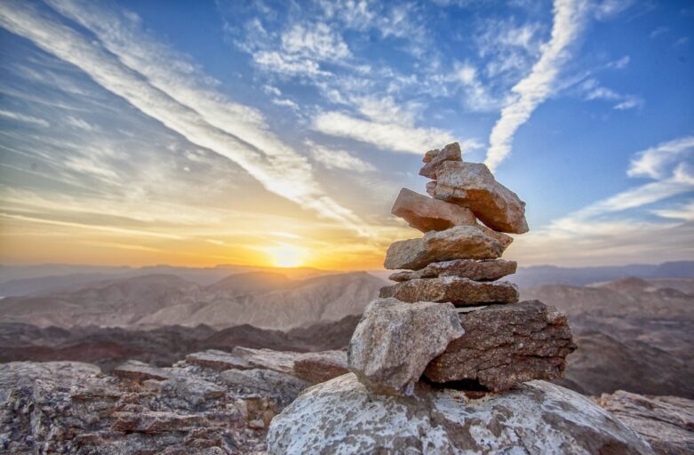
balanced rocks on a mountain

Plate tectonics is a fundamental concept in geoscience that explains the movement of Earth’s lithospheric plates and the geological phenomena associated with their interactions. In this blog, we will explore the role of plate tectonics in shaping Earth’s surface and its significance in the field of geoscience.

Plate Boundaries: Plate tectonics describes the boundaries where lithospheric plates interact. These boundaries can be classified into three types: divergent, convergent, and transform. Divergent boundaries occur where plates move away from each other, forming new crust and mid-oceanic ridges. Convergent boundaries are areas where plates collide, leading to the formation of mountains, volcanic arcs, and subduction zones. Transform boundaries involve plates sliding past each other horizontally, resulting in faults and earthquakes.

Volcanism

Plate tectonics plays a crucial role in the distribution of volcanic activity around the world. Volcanoes often form at convergent boundaries, where one plate subducts beneath another. The subducting plate melts, generating magma that rises to the surface, resulting in volcanic eruptions. Additionally, volcanic activity can also occur at divergent boundaries, such as mid-oceanic ridges, where magma wells up from the mantle, creating new crust.

Earthquakes

Plate tectonics is closely linked to seismic activity and the occurrence of earthquakes. Earthquakes commonly happen at plate boundaries, particularly along transform and convergent boundaries. As plates interact and strain builds up, it is released in the form of seismic energy, causing the ground to shake. Studying earthquakes helps geoscientists better understand plate movements, assess seismic hazards, and develop strategies for earthquake preparedness and mitigation.

Mountain Building

Plate tectonics is responsible for the formation of mountain ranges around the world. When two continental plates collide at a convergent boundary, the immense forces involved cause rocks to fold, thrust, and uplift, resulting in the formation of mountain belts. Examples of such mountain ranges include the Himalayas, the Alps, and the Andes. Studying mountain building processes helps geoscientists understand the forces that shape Earth’s topography and the geological history of different regions.

Plate Tectonics and Geoscience Research

Plate tectonics is at the core of many geoscience research areas. Geoscientists study plate boundaries to understand crustal deformation, magma generation, and the distribution of natural resources. They investigate past plate movements to reconstruct ancient supercontinents, track changes in sea level, and decipher climate variations. Additionally, the study of plate tectonics aids in the exploration of mineral deposits, petroleum reservoirs, and geothermal resources.

Understanding the dynamics of plate tectonics is crucial for comprehending Earth’s geological processes, natural hazards, and the formation of its diverse landscapes. Geoscientists continue to investigate and refine our understanding of plate tectonics, uncovering new insights into the intricate workings of our planet.

Unveiling Earth’s Secrets: The Tools and Techniques of Geoscience

mountain below of sky full of start

The field of geoscience relies on a variety of tools and techniques to investigate the Earth’s mysteries and unravel its secrets. In this blog, we will explore some of the key methods used by geoscientists to study our planet.

Remote Sensing

Remote sensing involves collecting data from a distance, typically using satellites, aircraft, or drones. Remote sensing techniques, such as aerial photography, multispectral imaging, and LiDAR (Light Detection and Ranging), provide detailed information about Earth’s surface, vegetation, topography, and land use patterns. These data help researchers study changes in landscapes, monitor environmental conditions, and assess natural hazards.

Seismic Imaging

Seismic imaging is a powerful technique used to investigate Earth’s subsurface structures. By analyzing the behavior of seismic waves generated by earthquakes or controlled explosions, geoscientists can create detailed images of the Earth’s interior. This method helps identify geological formations, map underground reservoirs of oil and gas, and understand the processes occurring deep within the Earth.

Geochronology

Geochronology involves determining the ages of rocks, minerals, and fossils. Geoscientists use various dating techniques, such as radiometric dating, which relies on the decay of radioactive isotopes, to establish the timing of geological events. Geochronology helps reconstruct Earth’s history, unravel past climate changes, and study the evolution of life on our planet.

Geographic Information Systems (GIS)

GIS is a computer-based system used to capture, analyze, and visualize spatial data. Geoscientists utilize GIS to integrate different types of information, such as maps, satellite imagery, and geophysical data. GIS enables the identification of spatial relationships, the creation of geologic maps, and the modeling of geological processes.

Core Sampling

Core sampling involves extracting cylindrical samples of rocks, sediments, or ice cores from the Earth’s surface or subsurface. Geoscientists analyze these samples to study the composition, structure, and properties of Earth materials. Core samples provide valuable information about past climates, geological formations, and the presence of natural resources.

These are just a few examples of the tools and techniques utilized in geoscience. As technology advances, new methods and instruments continue to enhance our understanding of the Earth and its processes, bringing us closer to unraveling its many mysteries.

Exploring the Marvels of Geology: An Introduction to Geoscience

mountain with blue background

Geoscience is a fascinating field that encompasses the study of the Earth and its processes. From rocks and minerals to landforms and natural hazards, geoscience provides valuable insights into our planet’s history and the forces that shape it. In this blog, we will delve into the world of geoscience and explore its various sub-disciplines.

Geology

Geology is the study of the solid materials that make up the Earth, including rocks, minerals, and the processes that form and shape them. Geologists investigate Earth’s history by examining the rock record and deciphering clues about past climates, tectonic events, and the evolution of life.

Geophysics

Geophysics focuses on understanding the physical properties and processes of the Earth through the use of physics principles and methods. Geophysicists use techniques such as seismic imaging, gravity measurements, and electromagnetic surveys to study the Earth’s interior, including its structure, composition, and dynamics.

Geochemistry

Geochemistry explores the chemical composition and behavior of rocks, minerals, fluids, and gases in the Earth’s systems. It investigates elemental abundances, isotopic ratios, and chemical reactions to unravel the processes that have shaped the Earth’s composition and influenced its evolution over time.

Geomorphology

Geomorphology examines the formation and modification of Earth’s surface features, including mountains, valleys, rivers, and coastlines. Geomorphologists study the processes of erosion, deposition, weathering, and tectonic activity to understand how landscapes evolve and change.

Paleontology

Paleontology is the study of prehistoric life based on fossil remains. Paleontologists analyze fossils to reconstruct ancient ecosystems, trace the evolution of species, and gain insights into Earth’s history, including mass extinctions and climate changes.

Natural Hazards

Geoscience plays a crucial role in understanding and mitigating natural hazards such as earthquakes, volcanoes, landslides, and tsunamis. Scientists study these phenomena to improve prediction and develop strategies to minimize their impact on human populations.

Geoscience offers a rich and diverse range of topics and research areas. By exploring these sub-disciplines, we can gain a deeper appreciation for the Earth’s complexity and the significant role it plays in shaping our environment and our lives.